
People love claiming they have been to the best and most beautiful of places, dined in the most prestigious of restaurants, and experience the most awesome of things ever perceived. Of course, I am trolling here, but there’s a truth to this, isn’t it? Some of us just want to seek what isn’t usually experienced by a whole lot of people, do what others won’t dare to do and just travel on the road less traveled. I think I have experienced that when my good friend, Karl Mikel (IG: @exkarlsions), and I ventured to the northernmost island of the Philippines: Mavulis Island.
Mavulis Island
Located 280 km away from the northern coast of mainland Luzon (and 150 km away from the southern tip of Taiwan ― yes, it is nearer to Taiwan than Luzon), Mavulis Island of the province of Batanes is the northernmost island in the Philippines. Albeit uninhabited, the island has a fisherman’s shelter, a lighthouse, a helipad and a flag to ascertain our sovereign over the area. The fisherman’s shelter, which is just recently finished, consists of a large room that can accommodate at least 20 people. When we went in the island during the summer of 2018, the shelter isn’t finished yet. We did see, though, that there were already the house, and a solar power facility meant to provide electricity to the shelter as well as a desalination plant for potable water. The fisherman’s shelter is built in the island to provide a temporary shelter for fishermen who would find it hard to go back to mainland Itbayat during stormy days.

Going to Mavulis Island
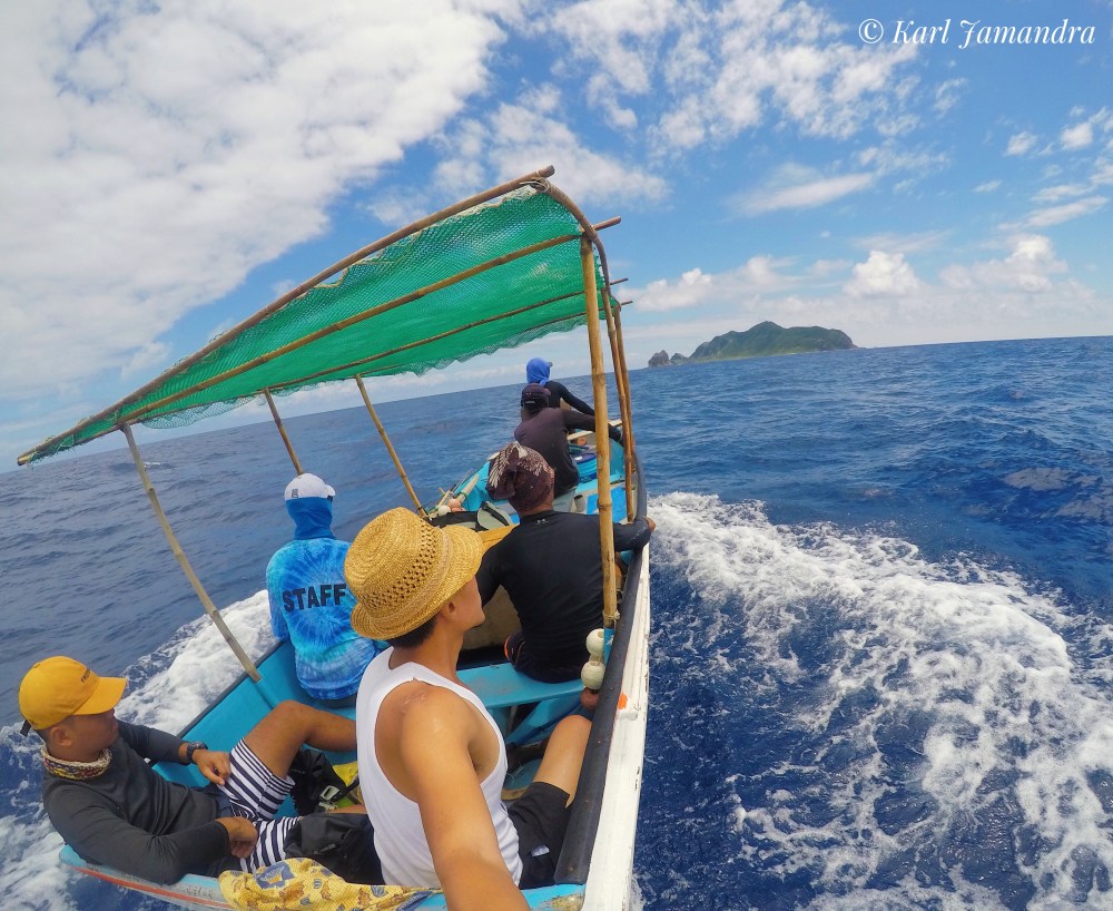
Mavulis Island is part of the municipality of Itbayat, which serves as jump off point when venturing towards the island. We have used a tataya, which is a small boat the fishermen use to fish along the Balintang Channel. You can choose to have just a whole day tour, or you can opt to do an overnight in another island after visiting Mavulis. As you will know, Mavulis is 38 km away from the island of Itbayat, and going there would entail about 3 to three-and-a-half hours of travel. An overnight rent of the boat would cost P10,000, while a whole day tour would be P7,000. You’ll be needing a guide, too, when you go there, and a tour guide fee costs P1,000 per day. Food isn’t inclusive in the fees, so we have arranged with our tour guide the food we would want to bring. We gave him a certain amount of money and suggested food we’d like to eat and voila! He has already cooked them by the time we were about to head on our exciting adventure to Mavulis. What made it more exciting was the fresh fish we got to eat in our trip! Because it’s the fishermen who went with us in the island (aside from our tour guide), they cooked fish they caught during the boat ride and shared them with us! I can still clearly remember the time we were eating back then in the islands!
Now, let me share with you our wonderful travel to Mavulis Island and its neighboring islands.

DAY 1
We woke up early in the morning to head to the port where our boat guides were waiting for us. We were already with our tour guide, Kuya Hector, who fetched us in Cano’s Lodge. It was a cool summer morning, and we were hoping it would continue until we finish our travel.
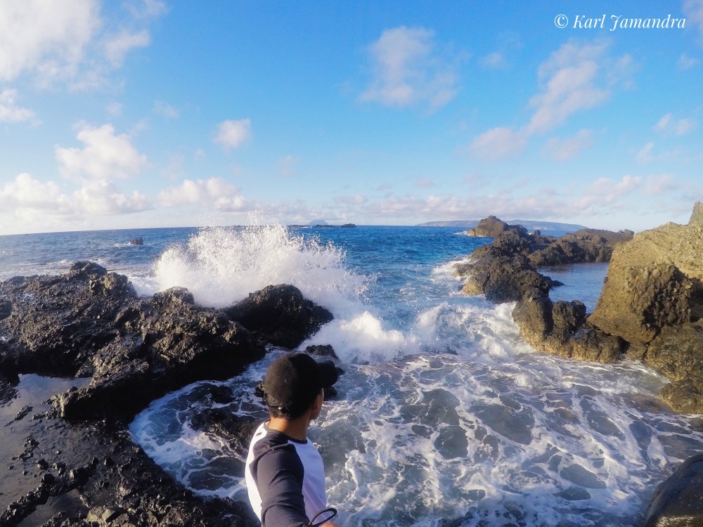
We left at 7:30 in the morning. We were six in the tataya: the three fishermen who from this time on I’m going to call the boat drivers; Kuya Hector, our tour guide; and of course, Karl Mikel and I. The sea surrounding the islands of Itbayat is kind of calm in the summer, and so we had a smooth ride for an hour or so. It wasn’t even halfway through when I felt the waves becoming bigger ― though our boat drivers said that’s still incomparable to the waves when it rains, much more so when there’s a storm!
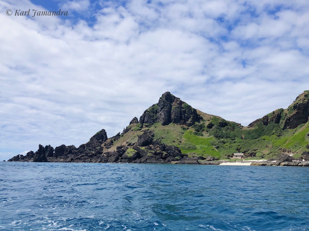
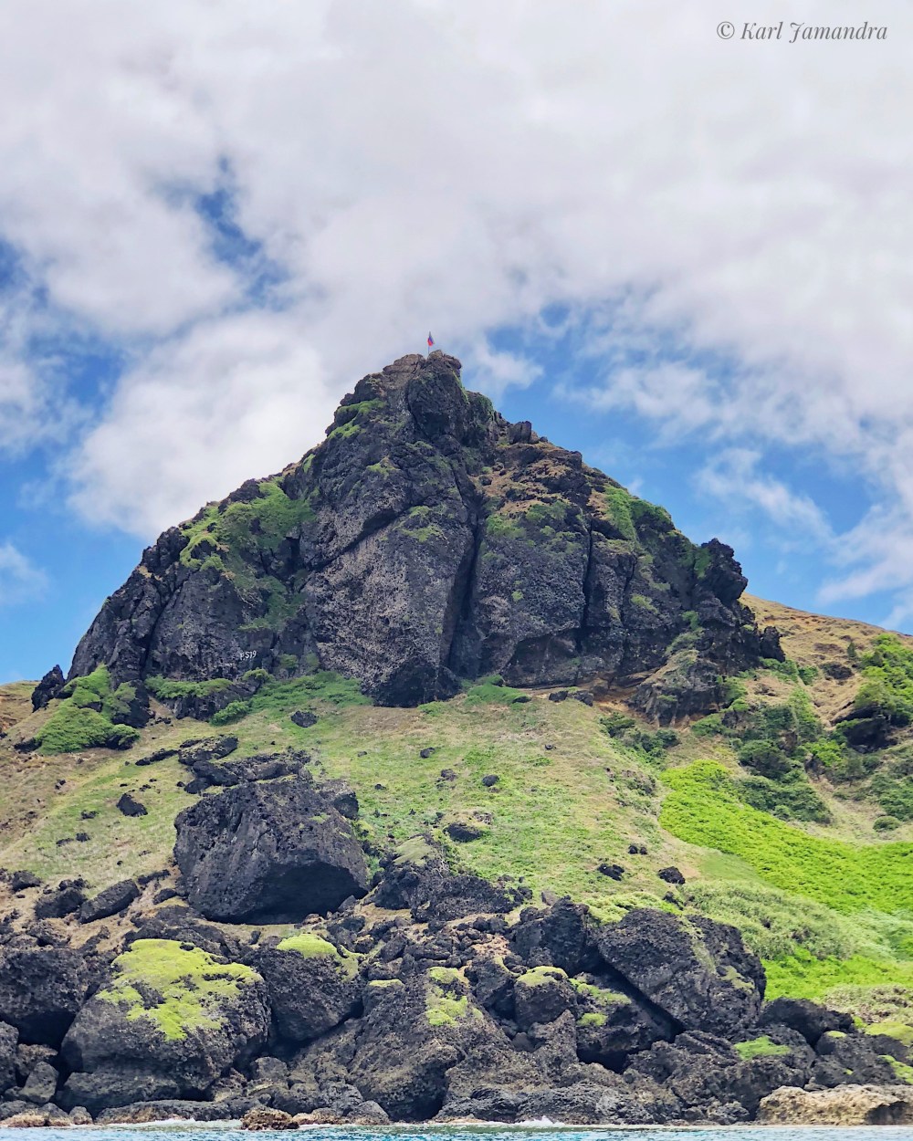
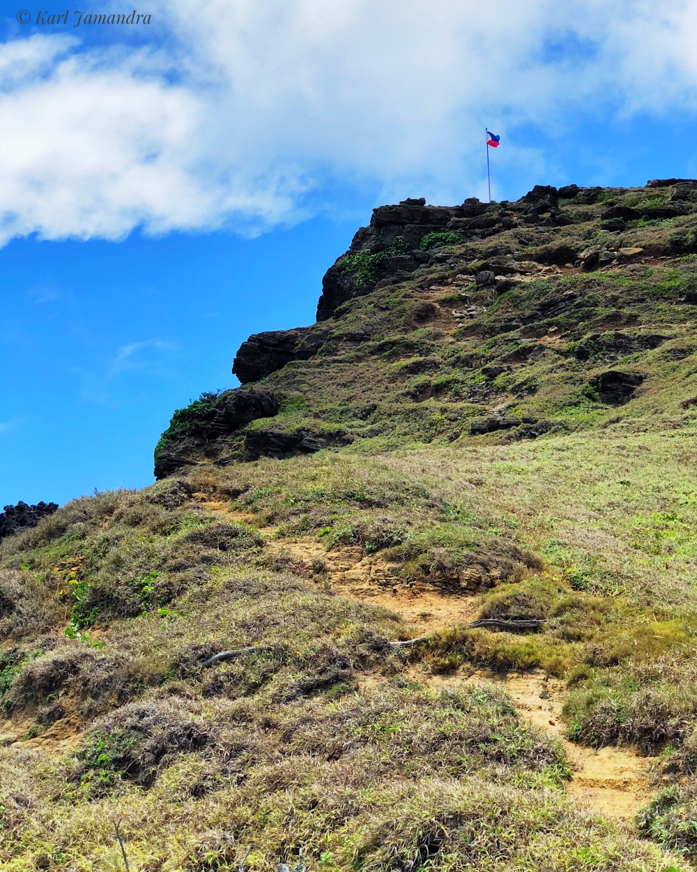
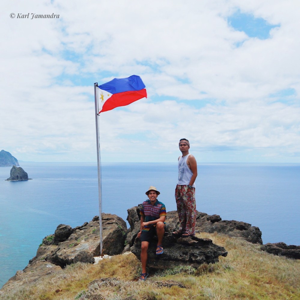
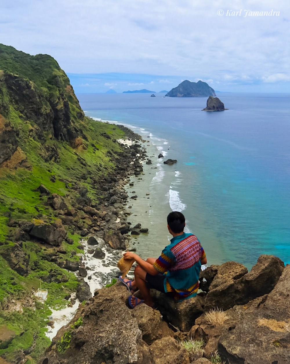
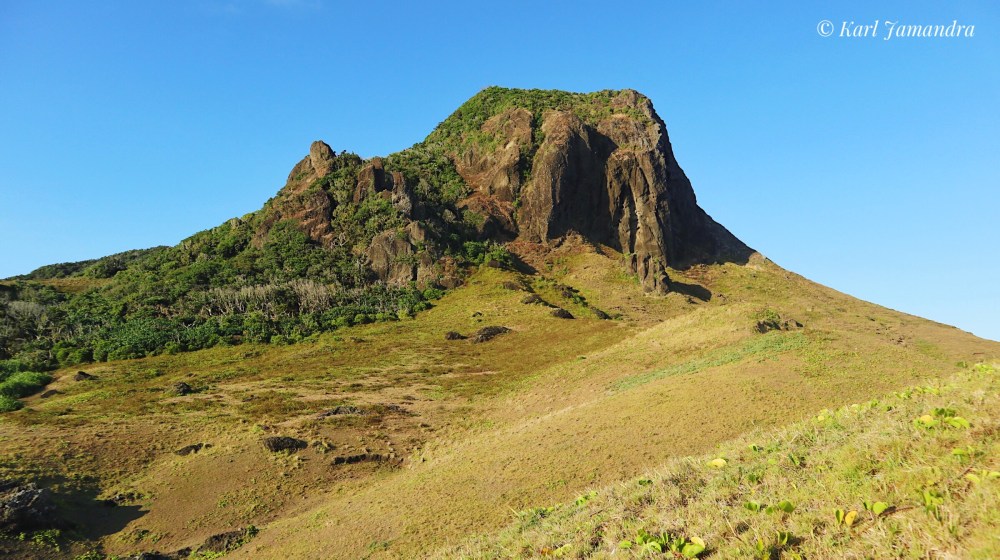
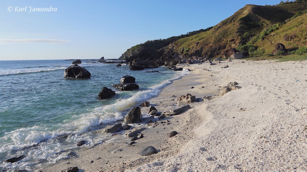
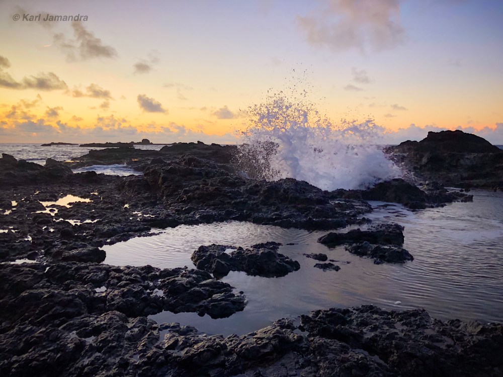
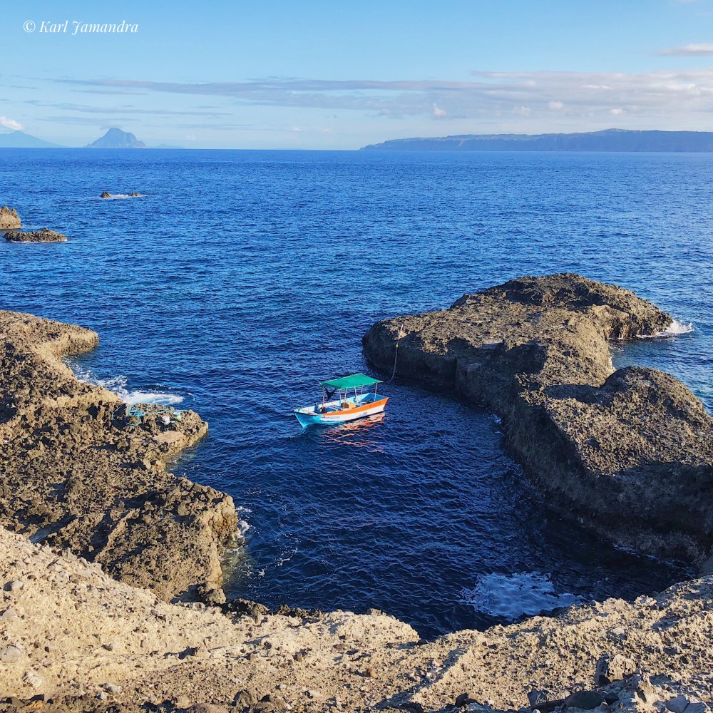
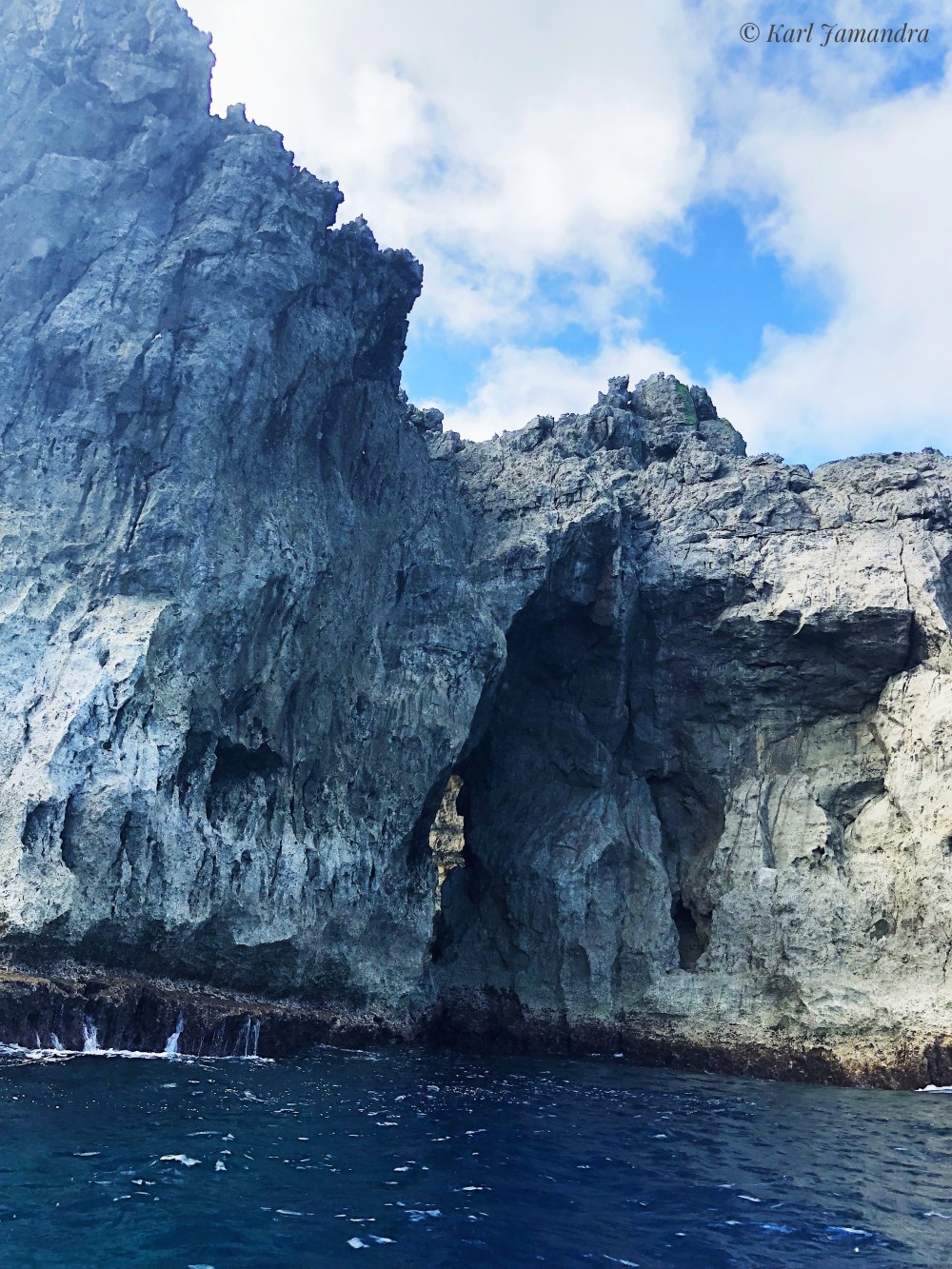
After more than three hours of praying and hoping we’d reach Mavulis Island safely, we finally saw it with our very own eyes! The island, which is 2.2 square km, has rocky shores, steep cliffs and mountains. Right on top of the tallest mountain in it we saw the Philippine flag, which symbolizes the ownership the Philippines has of the island.
We went down the boat. Our boat drivers and tour guide tried to trace the pathway going up the mountain where the Philippine flag is found. We thought it was going to be easy, but it really was not. The mountain might just be small, but it really was steep ― one misstep might mean falling down its cliffs. After about 30 to 40 minutes, we finally reached the peak! And what dawned on me was a proud feeling: the achievement of reaching the northernmost place in the country! I was all smiles upon seeing the Philippine flag as it waves strongly and uprightly.

I certainly enjoyed our short stay in the island appreciating our territory, taking scenic pictures and just taking in the feeling of being there ― something not too many people get to do. The whole island is definitely Batanes – grassy and rocky patches are seen all over while the sea along its coastline brims with azure colors. The whole feeling is still clear and vivid in my mind even though a year has already passed.


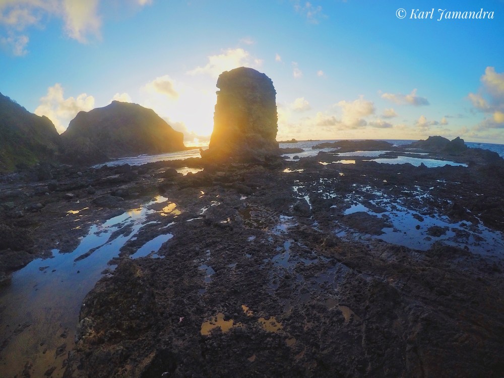
It was past 1 pm when we left Mavulis and headed to Siayam Island where we would be spending the rest of the day and sleep overnight. When we reached Siayam, the waves seemed to be getting bigger already. We then scoured for a good spot to spend the night later. We went behind a huge rock to protect us from strong winds should they come and put our belongings in a grassy area. Thank goodness we were able to bring our malong, because there were no trees to put our hammocks! So we’re going to either sleep on grass or rock. Ha! Of course, we could do that!
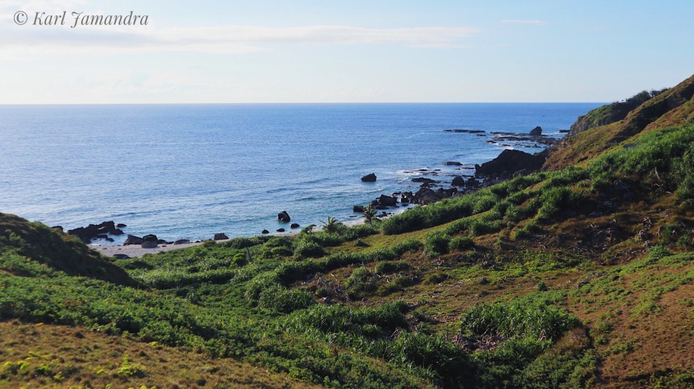
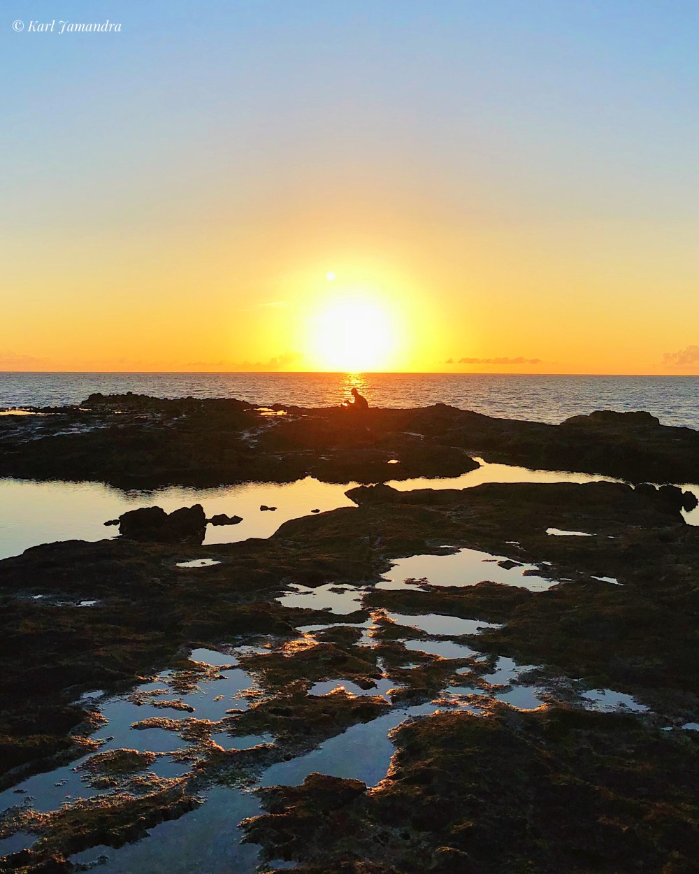
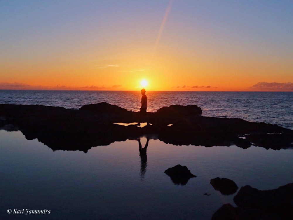
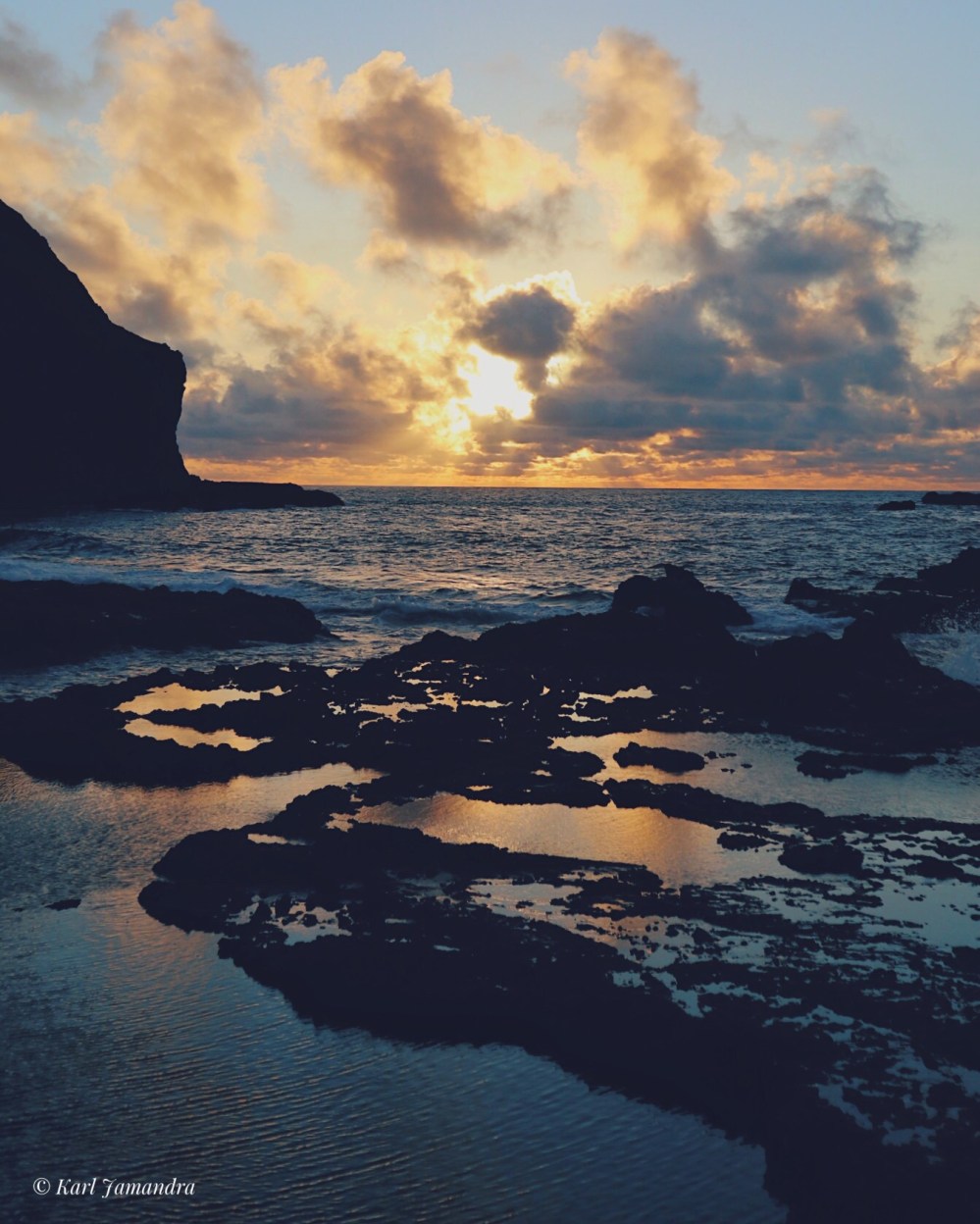
We explored the island, and headed towards the area where we could see the sunset. I wasn’t expecting anything, but what I saw was without a doubt stunning. Combined with a dramatic landscape, the sunset in Siayam Island was definitely one of the most beautiful sunsets I have ever seen!
Shortly after, we headed back to prepare for the evening. Mind you, there’s no electricity on the island, so when the night comes, we expect almost complete darkness. And that’s what actually happened. Even though there’s light coming from the moon and the stars, we still had to use our cellphones to manage eating dinner. The boat drivers cooked freshly caught fish and when eaten with rice, it was fantastic! We didn’t have complete sets of utensils, but we still managed to enjoy eating while sharing stories under the moonlit sky.
It was a tiring day, and so after eating dinner, we scrammed to find our sleeping spots. I chose a huge rock (much smaller than the rock I was talking about a while ago) to settle on. I laid down and just moved my head towards the sky. What I saw was a tear-jerking moment. It seemed like all the stars in the sky appeared that night, sharing their brightness with the moon to create a dreamlike panorama of the universe. That was one moment I would never forget, for the feeling, that feeling was invigorating.
I have written a poem called “Stars” on my phone under the bright night sky. I was enjoying the stellar show I was seeing, but what made it more dramatic was what I was feeling, too, at that time. If you want to read it, just ask me for a copy! Hehe.
DAY 2
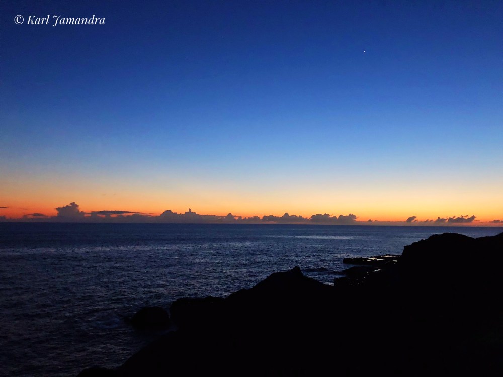
Sleeping early would only mean one thing for me: waking up early as well. It was past 4 AM when we woke up on our sleeping spots in Siyam Island so we could prepare to witness the sunrise that morning. We walked for about 30 or so minutes to reach a rocky part of the island where the sun was supposed to rise. However, it was all too cloudy that morning, so what we got was a light diffusion of sunrays amidst the clouds. But that was okay. It was still as beautiful as it could be.
We then proceeded back to our “camp” to eat breakfast and spend the rest of the morning before heading back to Itbayat. We again ate a variety of fish, which were freshly caught by our fishermen/ boatmen that morning. We then fixed up our things. Minutes before finally leaving, I breathed in the fresh air of the island and just reveled around my surrounding. I knew back then that this kind of beauty can only be experienced at such a rare time.

***
Who to contact
Time to learn who to contact when you want to experience Mavulis Island by yourself! I’d highly recommend Kuya Hector, who served us our travel guide in Itbayat. He doesn’t have a contact number, but look for him once you are in the island! Or, you can contact Kuya Olan, another tour guide in Itbayat, with this number: 0999-438-9321.
Meanwhile, the best place to stay in Itbayat is Cano Homestay, which is personally managed by Nanay Faustina Cano. She would welcome you with coffee, and a short lecture about Itbayat! Nothing can get better than that, you know? Here is her contact number: 0919-300-4787. You can ask Nanay Faustina to help you contact Kuya Hector, to arrange your travel there!
Estimated budget for Mavulis Island Travel
I’m just going to list down here things you need to have a budget on once you have settled in Itbayat. For the travel expenses in Itbayat itself, watch out for it in my Itbayat travel blog.
- Boat ride from Itbayat Island to Mavulis Island: P10,000 overnight (short stay in Mavulis Island, then overnight stay in Siyam Island)
- Tour guide: P1,000 per day (For Mavulis adventure, it’s P2000)
TOTAL: P3,000 per pax (in a group of 4)
***
Did you like my story about Mavulis Island, guys? I hope I got to successfully share with you how I felt when I have experienced traveling to the northernmost island of the Philippines. More so, I hope I have inspired you to travel as well in this stunningly wonderful island!

Hopefully to see this spot too, such a wonder to set foot on the northernmost edge of our archipelago.
LikeLiked by 1 person
Hi Jan! Syempre, ngayon lang kita nareplyan! Haha. You have to go to Mavulis when you visit Batanes! Sobrang ganda run!
LikeLiked by 1 person
thanks. great story and great pictures. didn’t saw any pictures of the night skies though.
LikeLiked by 1 person
Sorry, I didn’t get to capture one while in Mavulis! But I do have one in another part of Batanes. 🙂
LikeLike